✨ New Arrivals Just Dropped!Explore

Map of Falmouth Haven print
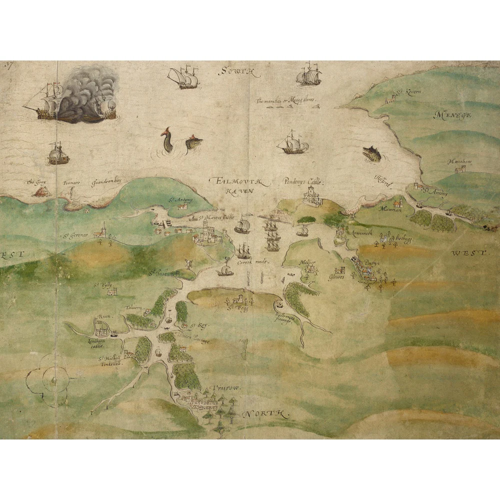
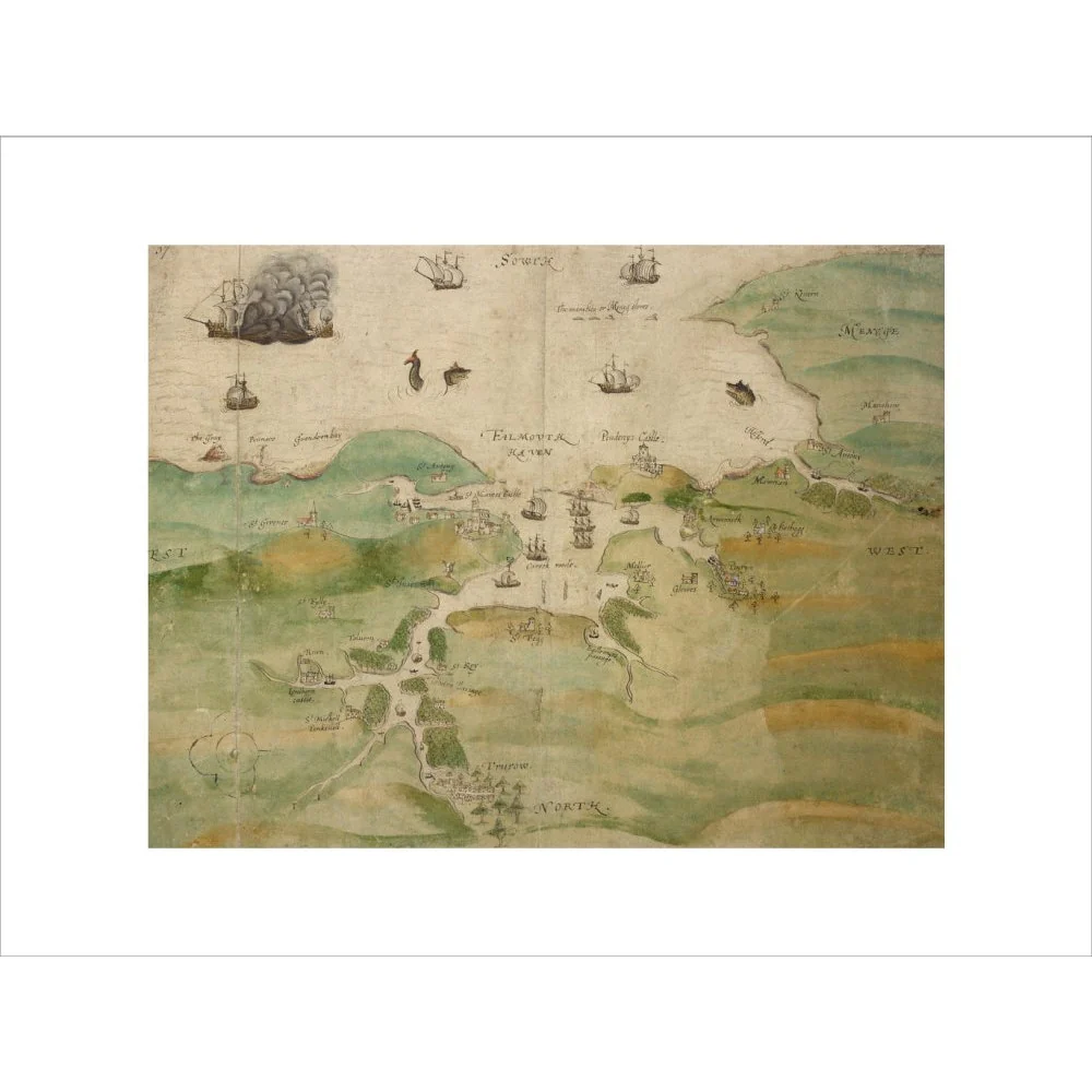
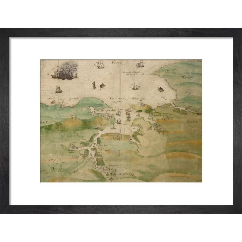
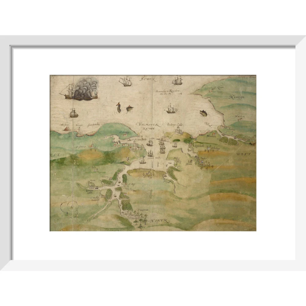
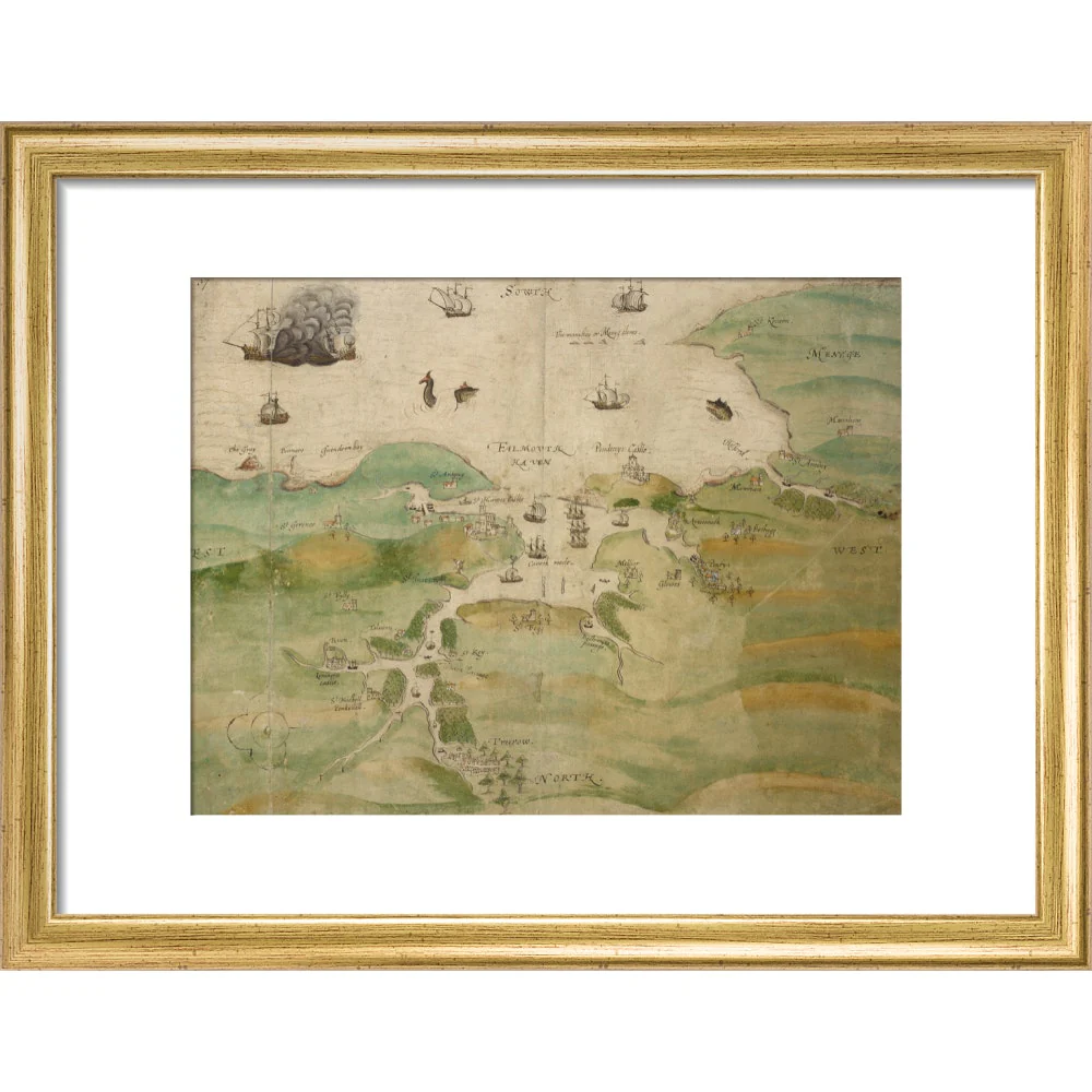
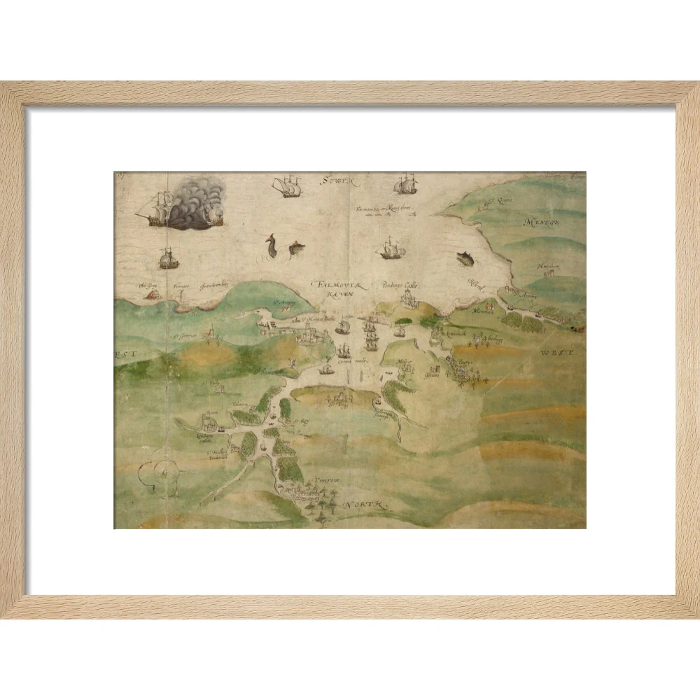
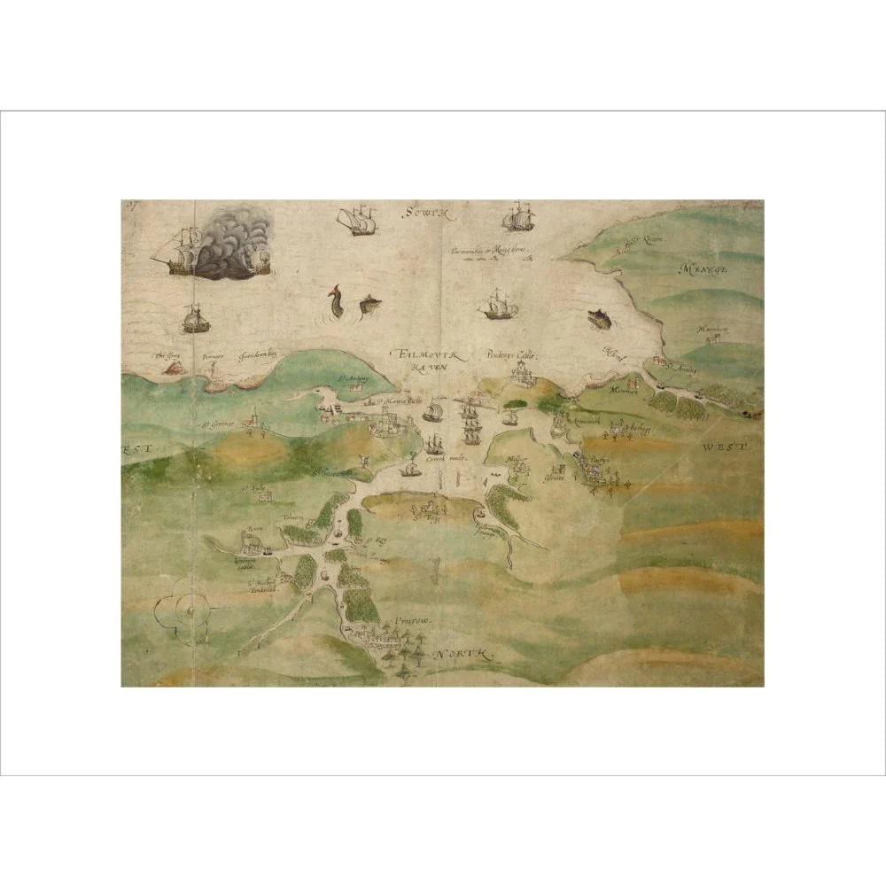
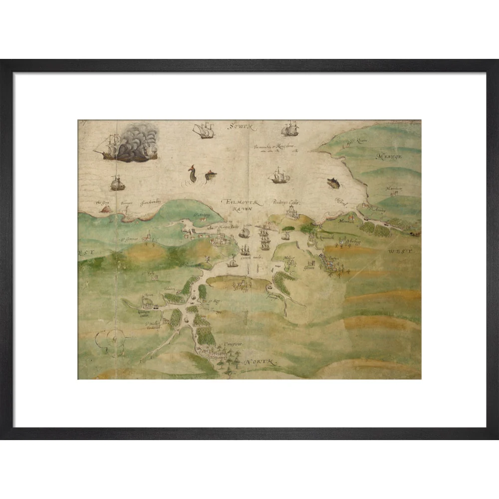
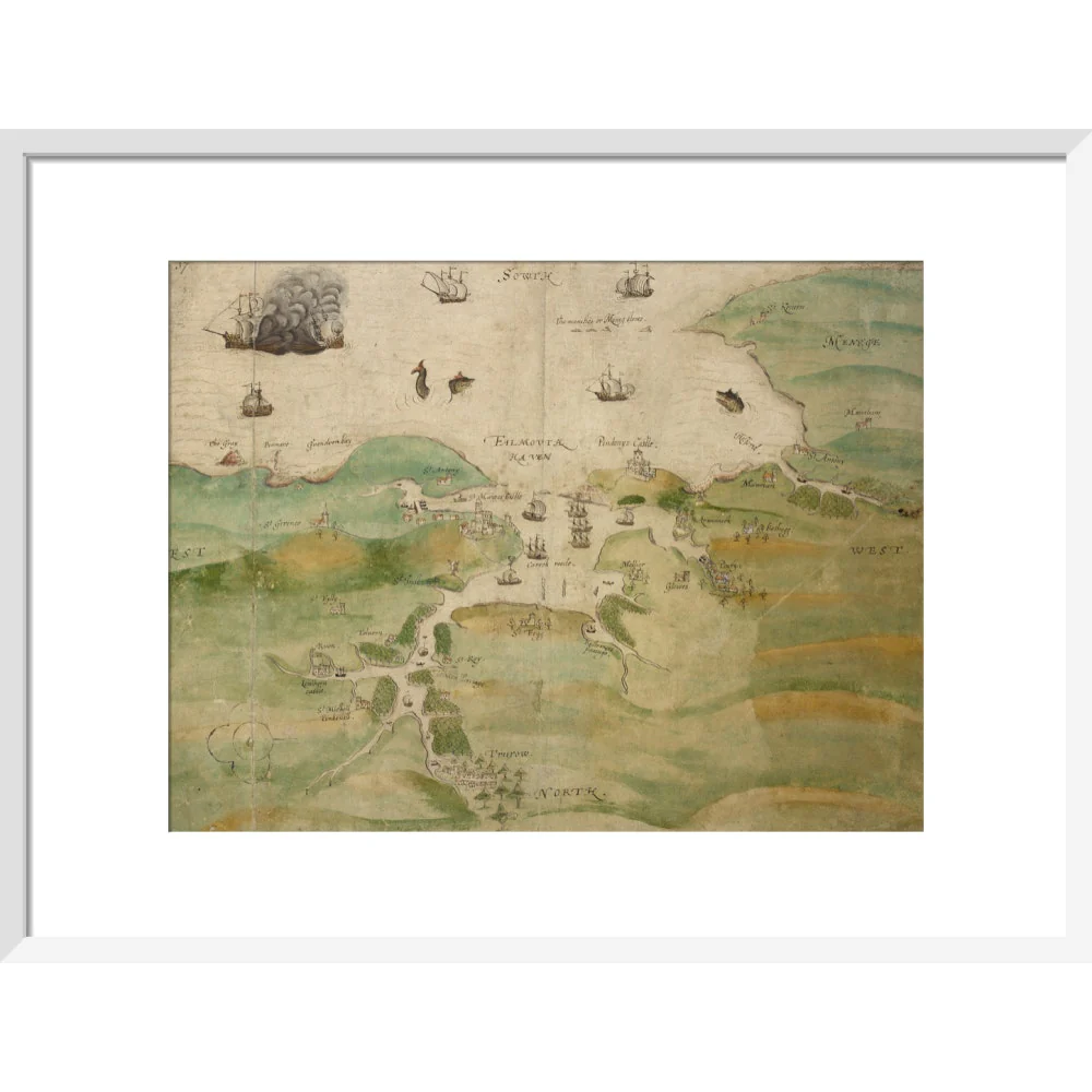
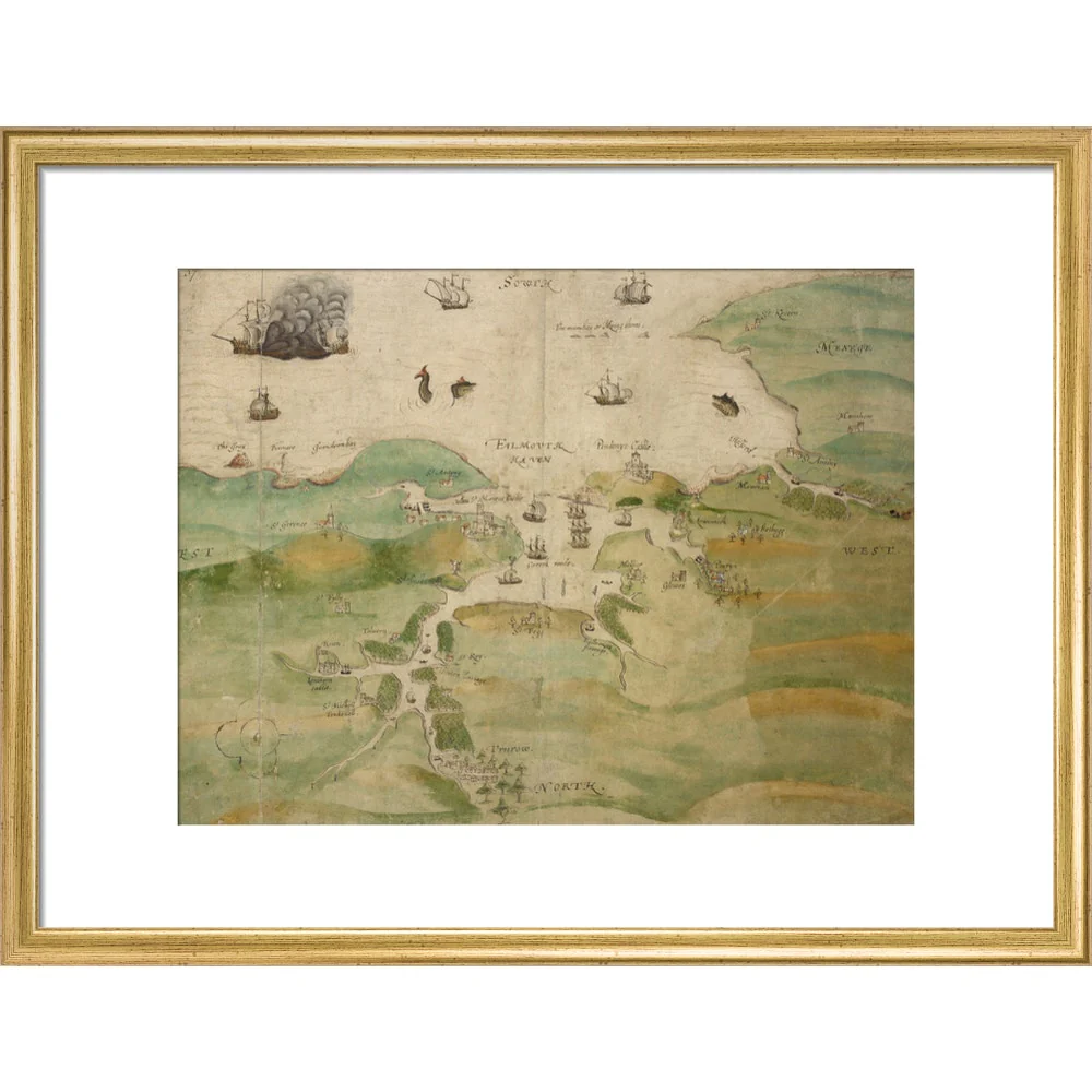
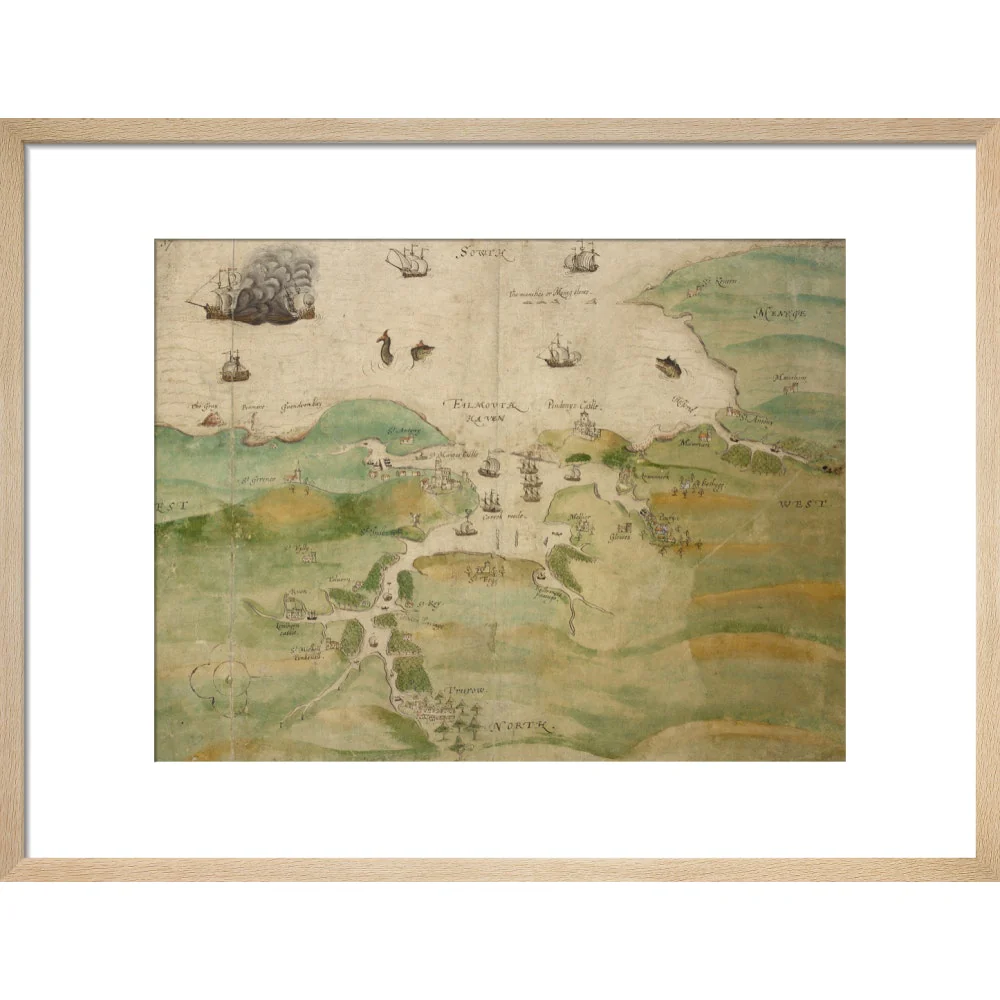
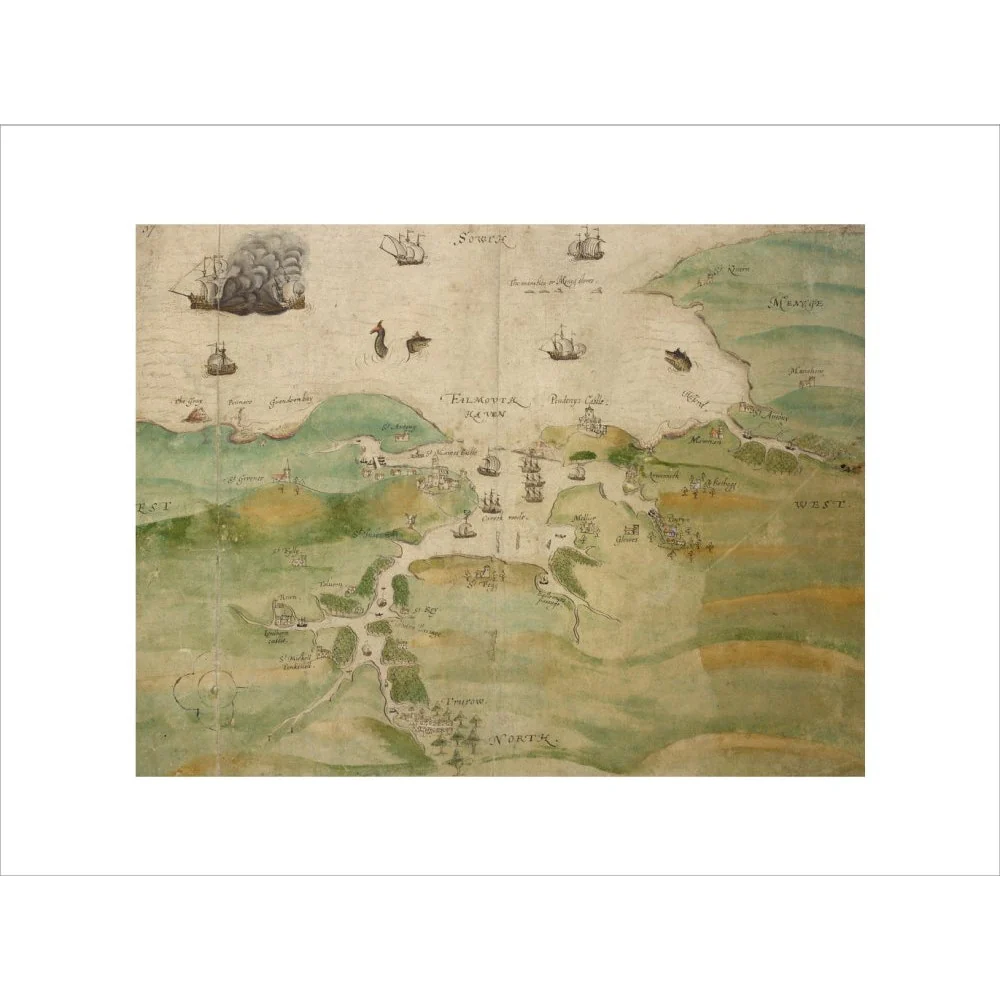
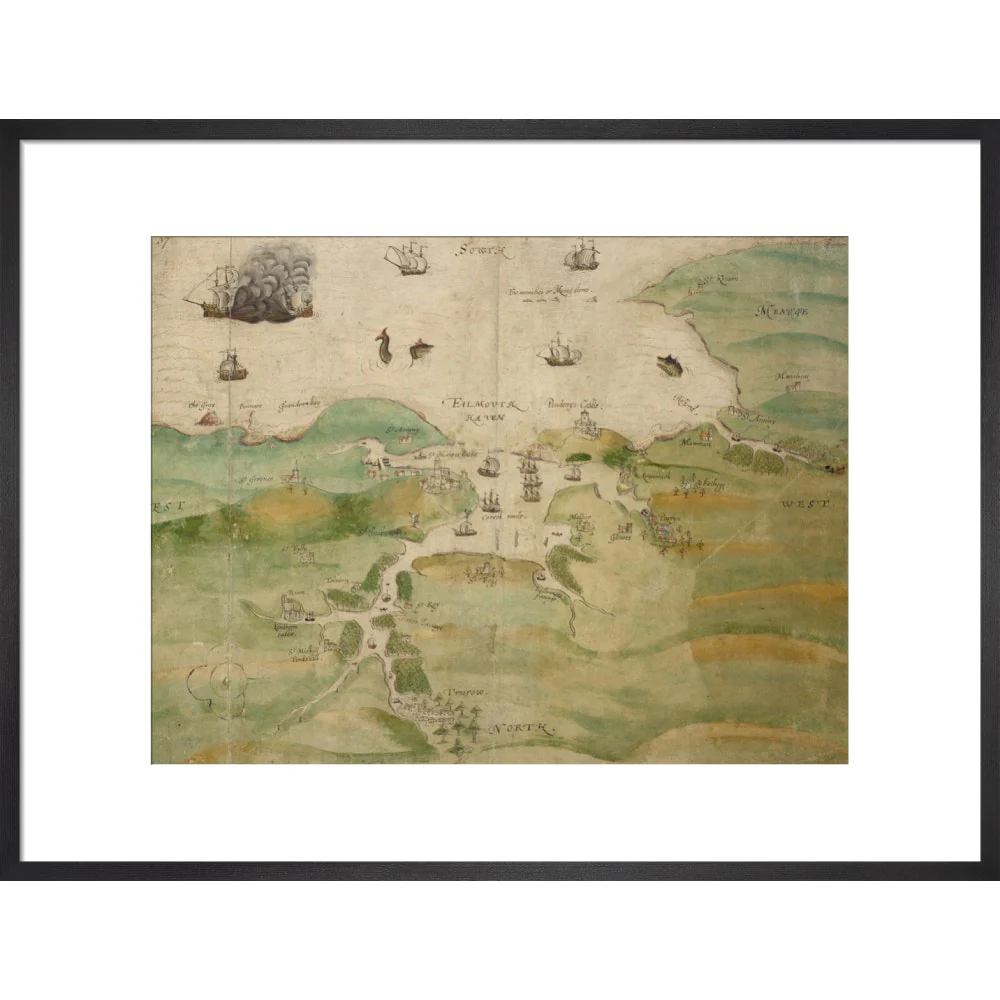
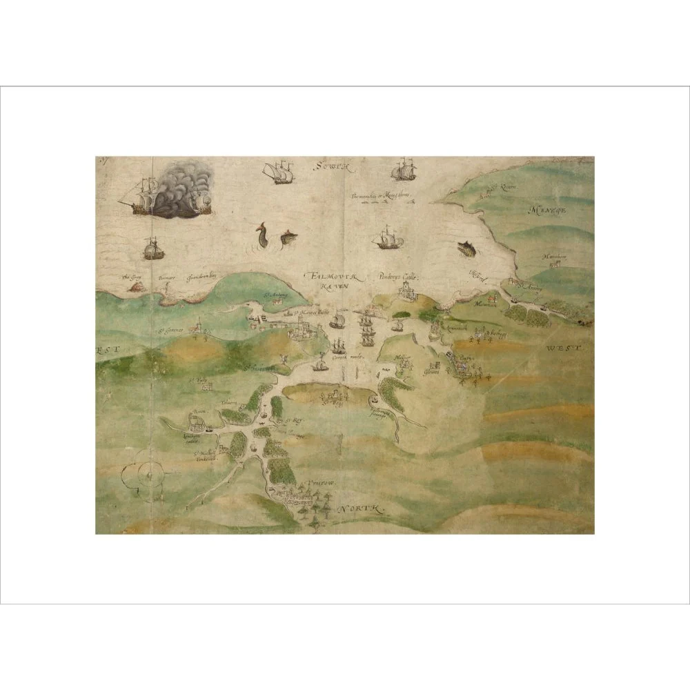
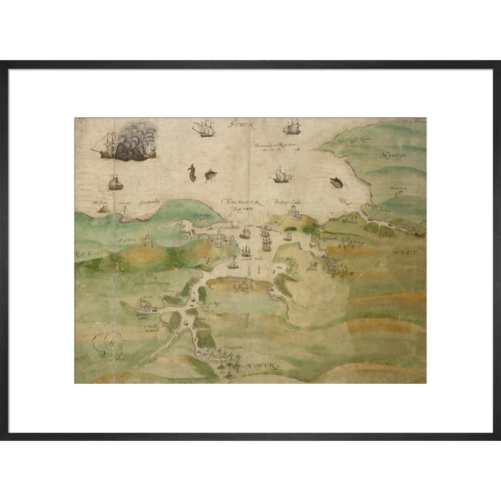
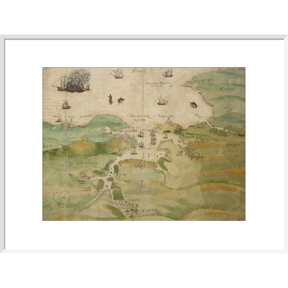
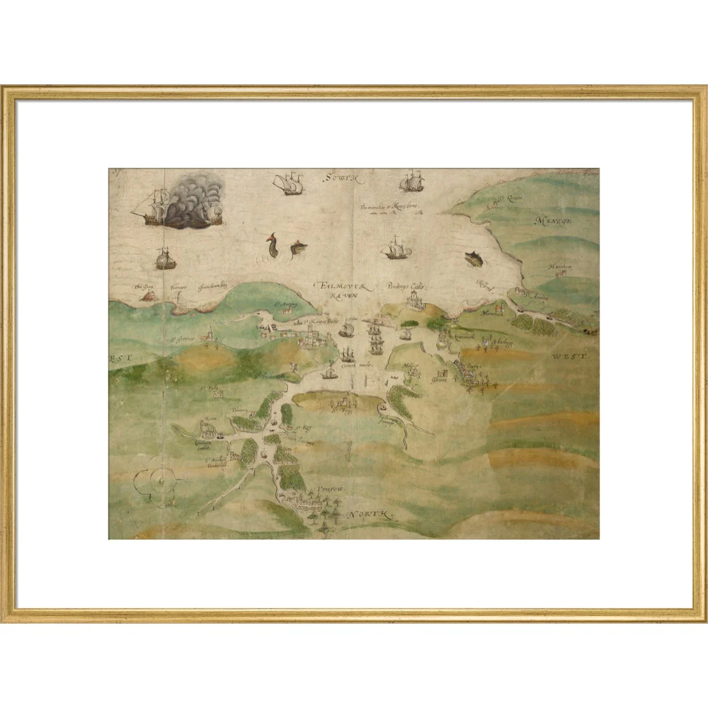
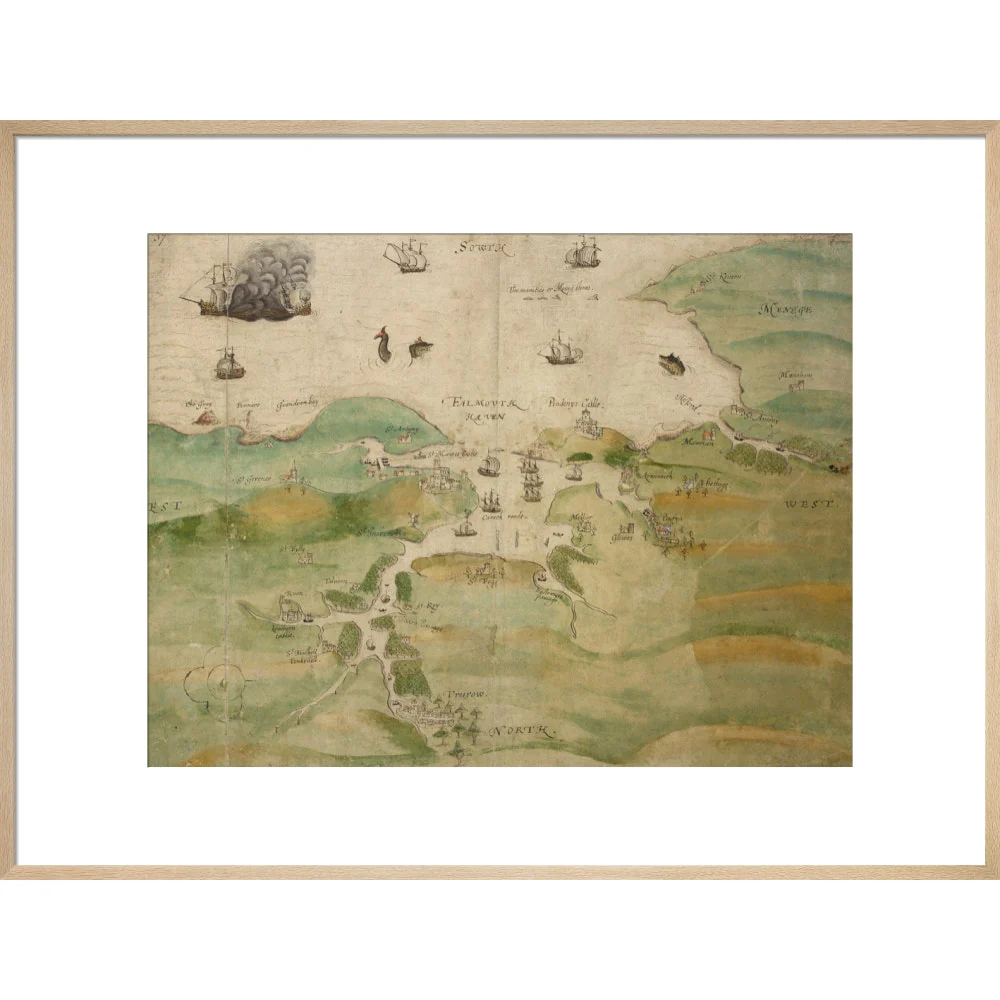
Map of Falmouth Haven and the River Fal as far as Truro.
This 16th century drawing describes the Fal estuary in Cornwall, from Falmouth (the mouth of the river Fal) to Truro. The inclusion of Pendennis and St Mawes Castles suggest that the drawing was made after the 1540s, when the two castles were built. These castles formed part of a defensive chain built by King Henry VIII (1491–1547) after a peace treaty was signed by King Francis I of France (1494–1547) and Charles V, Holy Roman Emperor and King of Spain (1500–1550) in 1538, making invasion of England probable.
This drawing was probably made as a record of this vulnerable area of the coast for defensive purposes. It is possible that it may date from 1598–1599 when the military engineer Paul Ivey was responsible for strengthening St Mawes and Pendennis following the threat posed by the 3rd Spanish Armada to England, and the Cornish coast, in 1597. Despite the accurate plotting of key castles, towns and defensive structures on this map, much of the detail – including the depictions of the castles, and the naval battle in the top left – can only be described as fanciful. However, the clover leaf pattern in the bottom left hand corner does represent an accurate ground plan of St Mawes Castle: though, a later hand may have drawn this in an attempt to correct the inaccuracy of its pictorial depiction in this drawing.
Shelfmark: Cotton Augustus I i f.37
This 16th century drawing describes the Fal estuary in Cornwall, from Falmouth (the mouth of the river Fal) to Truro. The inclusion of Pendennis and St Mawes Castles suggest that the drawing was made after the 1540s, when the two castles were built. These castles formed part of a defensive chain built by King Henry VIII (1491–1547) after a peace treaty was signed by King Francis I of France (1494–1547) and Charles V, Holy Roman Emperor and King of Spain (1500–1550) in 1538, making invasion of England probable.
This drawing was probably made as a record of this vulnerable area of the coast for defensive purposes. It is possible that it may date from 1598–1599 when the military engineer Paul Ivey was responsible for strengthening St Mawes and Pendennis following the threat posed by the 3rd Spanish Armada to England, and the Cornish coast, in 1597. Despite the accurate plotting of key castles, towns and defensive structures on this map, much of the detail – including the depictions of the castles, and the naval battle in the top left – can only be described as fanciful. However, the clover leaf pattern in the bottom left hand corner does represent an accurate ground plan of St Mawes Castle: though, a later hand may have drawn this in an attempt to correct the inaccuracy of its pictorial depiction in this drawing.
Shelfmark: Cotton Augustus I i f.37
Creator: Anonymous
Select Type
Select Size
Select Frame
From $11.72
Original: $33.50
-65%Map of Falmouth Haven print—
$33.50
$11.72Product Information
Product Information
Shipping & Returns
Shipping & Returns
Description
Map of Falmouth Haven and the River Fal as far as Truro.
This 16th century drawing describes the Fal estuary in Cornwall, from Falmouth (the mouth of the river Fal) to Truro. The inclusion of Pendennis and St Mawes Castles suggest that the drawing was made after the 1540s, when the two castles were built. These castles formed part of a defensive chain built by King Henry VIII (1491–1547) after a peace treaty was signed by King Francis I of France (1494–1547) and Charles V, Holy Roman Emperor and King of Spain (1500–1550) in 1538, making invasion of England probable.
This drawing was probably made as a record of this vulnerable area of the coast for defensive purposes. It is possible that it may date from 1598–1599 when the military engineer Paul Ivey was responsible for strengthening St Mawes and Pendennis following the threat posed by the 3rd Spanish Armada to England, and the Cornish coast, in 1597. Despite the accurate plotting of key castles, towns and defensive structures on this map, much of the detail – including the depictions of the castles, and the naval battle in the top left – can only be described as fanciful. However, the clover leaf pattern in the bottom left hand corner does represent an accurate ground plan of St Mawes Castle: though, a later hand may have drawn this in an attempt to correct the inaccuracy of its pictorial depiction in this drawing.
Shelfmark: Cotton Augustus I i f.37
This 16th century drawing describes the Fal estuary in Cornwall, from Falmouth (the mouth of the river Fal) to Truro. The inclusion of Pendennis and St Mawes Castles suggest that the drawing was made after the 1540s, when the two castles were built. These castles formed part of a defensive chain built by King Henry VIII (1491–1547) after a peace treaty was signed by King Francis I of France (1494–1547) and Charles V, Holy Roman Emperor and King of Spain (1500–1550) in 1538, making invasion of England probable.
This drawing was probably made as a record of this vulnerable area of the coast for defensive purposes. It is possible that it may date from 1598–1599 when the military engineer Paul Ivey was responsible for strengthening St Mawes and Pendennis following the threat posed by the 3rd Spanish Armada to England, and the Cornish coast, in 1597. Despite the accurate plotting of key castles, towns and defensive structures on this map, much of the detail – including the depictions of the castles, and the naval battle in the top left – can only be described as fanciful. However, the clover leaf pattern in the bottom left hand corner does represent an accurate ground plan of St Mawes Castle: though, a later hand may have drawn this in an attempt to correct the inaccuracy of its pictorial depiction in this drawing.
Shelfmark: Cotton Augustus I i f.37
Creator: Anonymous